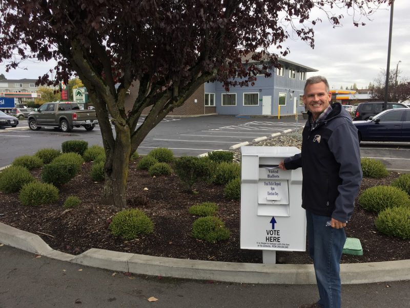
The Ferndale School District is holding a vote on a proposed bond to fund a new Ferndale High School, repairs to our local elementary and middle schools, a modern Performing Arts Center and safety improvements throughout the school district.
Ballots are due by Tuesday, Feb. 12th. Please utilize the ballot dropbox between City Hall and the Library to ensure your ballot is counted.
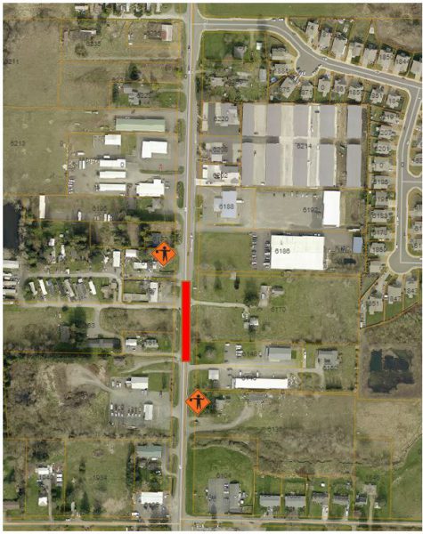
Notice Traffic Revisions and Possible Delays: Tuesday, January 29, 2019 to Thursday, January 31, 2019, 7:00am to 7:00pm
Portal Way, between McKinley Street and Newkirk Road
Drivers should expect delays as traffic is reduced to single lane traffic on Portal Way between McKinley Street and Newkirk Road from Tuesday, January 29, 2019 to Thursday, January 31, 2019, from 7:00am to 7:00pm. Flaggers will be on-site directing traffic. This work is to complete improvements associated with a private development project. Road will remain open during nonworking hours.


| City Council Agenda Follow-Up January 22, 2019 | |
| CALL TO ORDER/FLAG SALUTE/ROLL CALL | |
| PUBLIC COMMENT | INFO ONLY |
| CONSENT AGENDA Councilmember Taylor moved, and Councilmember K. Hansen seconded, to approve the consent agenda. MOTION CARRIED 7-0. | APPROVED |
| PRIVATE DEVELOPMENTS UPDATE Community Development Director Haylie Miller presented updates on the following private development project: Smith Meadows – Located on West Smith Road. This is a 3.8-acre parcel with 11 parcels, zoned RS Low. (3 – 5 units per acre) The roads, utilities, and all infrastructure have been completed. The next step is for the applicant to submit the final plat application to the City. | INFO ONLY |
| PRESENTATION: Community Development Department 2019 Legislative Plan Community Development Director Haylie Miller presented Community Development projects planned for 2019, including: Shoreline Master Plan (SMP) Update: Many sections in the City’s SMP are outdated and need to be modified to reflect City goals and to comply with State guidelines.Planned Unit Development (PUD) Code Modifications: Current PUD code language is outdated and should be rewritten.Multifamily High Rezone: Replace the RM 1.5-Multiple Dwelling and Residential Office Zones within proximity of the Downtown Core with a new zone referred to as the Residential Multifamily High Zone. Ferndale-Priority Mitigation Program: Mitigation is described as compensation for project-related impacts to regulated biological critical areas. The focus of this program will be on those areas within the FEMA 100-year floodplain and stream/river shorelines. The program is to be available for projects across jurisdictional boundaries with mitigation to occur within the city limits and UGA. Application Vesting Regulations: Review application vesting regulations and timelines specifically for land use applications to assure appropriate timelines are in place and regulations are clear.Catalyst Development: Establish a Downtown Catalyst incentive program that includes a waiver of all administrative, impact, and connection fees for up to three development projects meeting all required criteria to assist in the development of a vibrant downtown core.Mobile Home Park Developments: Currently, there is no zone in which mobile home parks could be located. Street Trees: The City’s Tree Ordinance was adopted in 1999 and has not been updated since. Proposed updates will include modification of tree spacing requirements, more flexibility, and will establish themes along certain corridors.Park Development Standards Details: Adopt trail standard details. The current code has one trail detail that does not work in all cases. Multifamily Parking Regulations: Research possible code changes, if necessary, to clarify whether “off-street” parking means on -site or within a garage. | INFO ONLY |
| CONTRACT: WWU Sustainable Communities Partnership Interagency Agreement AS part of the 2019 budget the City Council authorized funds to support a multi-disciplinary partnership between the City of Ferndale and Western Washington University for the purpose of exploring opportunities and challenges related to Downtown Ferndale and the surrounding areas. The proposed partnership is intended to bring the broad resources of WWU and its Sustainable Communities Partnership (SCP) to bear on the issue. Since its inception three years ago, the SCP has worked with the City of Edmonds, the City of Stanwood, and Skagit County to advance those jurisdictions’ planning. Work is performed by WWU students from several disciplines as part of an academic year-long effort. These students are typically juniors or seniors who are working at the direction of professional faculty with expertise on their respective fields. The final documents that will be provided to the City are at a standard that would be typical for professional consultants, at a fraction of the overall cost of a consultant. Councilmember Kennedy moved, and Councilmember Taylor seconded, to approve the agenda bill. MOTION CARRIED 7-0. | APPROVED |
| ADJOURNMENT: Meeting was adjourned at 7:10 p.m. |

Looking for some creative fun in Ferndale to get you through the winter?
Join mosaic artist Debbie Dickinson at a Ferndale Arts Commission sponsored community art project. We’ll work together to create elements of a mosaic garden to be installed by Debbie outside the library this Spring. Piece together colorful flowers and leaves using pre-made forms and supplied materials and instruction. FREE and open to all Ferndale residents. Children under 12 must be accompanied by an adult.
Workshop Details–
Dates: Saturdays, January 12th & 26th, February 9th and 23rd
Times: Drop-in any time between 9:30am and 1pm, workshop ends at 2:30. Expect to spend about an hour on a piece of the mosaic wall creation.
Location: Pioneer Pavilion at Pioneer Park (2007 Cherry Street).
Finished work will become part of the Library Mosaic Project outside of the Ferndale Library. For more information, please call Susan Duncan at (360) 685-2354.

The Ferndale Food Bank, located at 1671 Main St. in Ferndale, has decided to offer a special distribution to our unpaid federal employees. The distribution will take place on Tuesday, January 22 beginning at 10 AM ending at 1 PM and then again from 5pm- 7pm. Please bring a copy of your ID and a recent Federal government paystub. They will be serving those living in our service area which includes Ferndale School District, very north bit of Bellingham and Custer.
The Ferndale Food Bank wants to reinforce with these workers that their work is important to us and we want to support them in anyway we can during this challenging time.
Please call Suzanne Nevan, the director of the Ferndale Food Bank with any additional questions at 360-223-0788 or you can email by clicking here.
NOTICE OF A POTENTIAL QUORUM
Notice is hereby given that one or more members of the Ferndale City Council may attend the following meeting:
Town Meeting – A Visioning Workshop for a Ferndale City Center Plan
Wednesday, January 23, 2019, 6:00 p.m.
Pioneer Pavilion
2007 Cherry Street Ferndale, WA
This meeting is sponsored by Western Washington University and the Ferndale Chamber of Commerce. The purpose of the meeting is a visioning workshop for a Ferndale City Center Plan. Planning topics include: Transportation Solutions, Urban Infill, Architectural Character, Safe Routes to School, Habitat Enhancement, Public Parking, Park and Trails, Flood Risk Reduction, Children’s Activities.
This is an Open Public Meeting as outlined by the Open Public Meetings Act, and members of the public are invited to attend and observe.
Susan Duncan, City Clerk
Basic Emergency Preparedness Workshop
Empower yourself and your family. Join us to learn more about what supplies and resources to have on hand when a natural or human-made disaster occurs. All are welcome. Light refreshments provided.
Ferndale Community Emergency Response Team (CERT)
Date: Thursday, January 17, 2019
Time: 6:00 p.m. – 7:30 p.m.
Location: Meeting Room,
Ferndale Library
2125 Main Street
Hosted by Ferndale Community Emergency Response Team (CERT). Ferndale CERT is one of the member organizations of the FERN and working with the Ferndale Police Department. For more information, please email Gayland Gump by clicking here

Last year, over 3,000 residents enjoyed free recreational activities in Ferndale’s parks. In 2019, we want to bring you even more great parks and rec offerings. Help us decide which events to sponsor by taking our 2019 Parks and Rec Activity Survey.
Your responses to this survey shape what events we host and how we advertise them in 2019. The whole survey should take about six minutes to complete, we appreciate your input.
For more information or questions, please call Recreation Coordinator Riley Sweeney at (360) 685-2353 or email him by clicking here.